Industry News Ride Spot

Ride Spot: North Rim of the Grand Canyon

Kanab Point

By Jon Crowley

The Grand Canyon is magnificent, but in my opinion part of what makes a place special is experiencing it without hoards of people that unload off a bus and spoil the views with their social media selfies.

Toroweap Overlook

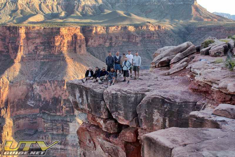
My first trip to Toroweap Overlook in 2008

To me, Toroweap on the north rim of the Grand Canyon has been that go to spot. The views are spectacular, but over the last decade, it has become quite popular as well. It will never be like the south rim, but you do need a permit now (limiting the amount of people per day). If you haven’t gone to Toroweap, put it on your to-do list.

Get your Grand Canyon and Arizona Permits:

Are you planning a visit to Toroweap Valley, Tuweep, or Kanab Plateau? This is all part of the Grand Canyon National Park and permits are required. The area is being patrolled, so don’t forget to get a day use ticket – $2/ticket/vehicle. Other requirements: highway license plate / insurance required. Noise limit = normal conversation; 60 dBA at 50 ft (15.2 m). Driving muddy roads prohibited. UTV’s must display AZ off road sticker.

https://www.nps.gov/grca/planyourvisit/upload/TuweepSiteBulletin_2023-11-27.pdf

But if you want to get away from almost everyone, there are a few other options that are worth the trip:
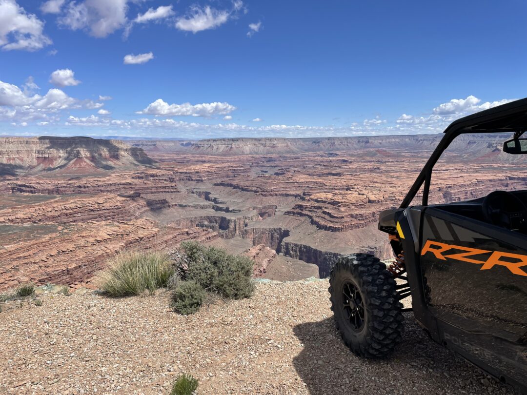
Whitmore Canyon

Whitmore Canyon

Whitmore Canyon Overlook

Whitmore Canyon Viewpoint, located on the remote North Rim of the Grand Canyon, offers one of the most breathtaking and least crowded vistas of this iconic natural wonder. Accessible primarily by high-clearance vehicles via dirt roads from Bar 10 Ranch, this viewpoint provides a stunning panoramic view of the Colorado River as it carves its way through the canyon’s rugged terrain. Unlike the more commercialized South Rim, Whitmore Canyon allows visitors to experience the Grand Canyon in its raw, untouched beauty, often without another soul in sight. The viewpoint also serves as a popular launching point for rafting trips, with a trail leading down to the river’s edge. Its remote location and unparalleled scenery make it a must-visit for adventure seekers looking to explore the Grand Canyon away from the crowds.

Whitmore Canyon Overlook GPS Coordinates: 36.15215, -113.20426

Kanab Point

Kanab Point

Kanab Point

GPS Coordinates: 36.40062, -112.65166

SB Point Grand Canyon

SB Point

SB Point

GPS Coordinates: 36.30055, -112.84111

Both of these locations are fairly easy to reach from either Colorado City, AZ or near Pipe Springs National Monument. There are several different routes you can take, and most are open until you get into the actual National Park boundary.

Grand Canyon National Park

Sign as you cross into National Park land

I am not sure about the permit for Kanab Point and SB point as the sign seems to be referring to Tuweep (Toroweap Overlook), but it sounds like NPS wants you to get a permit for these areas as well which doesn’t make any sense.

Once in the park, we saw several trails to get from Kanab Point over to SB Point that were on Gaia GPS and onX Off-Road.  Unfortunately, the NPS has decommissioned these trails and it forces you to back track further before heading back to the rim. This was a bit frustrating because I am sure these trails have existed for decades.

Closed Route

Trail that used to connect Kanab Point to SB Point that is now closed.

If you are looking for a route, I did not record ours and we hit a lot of closed trails which made us go to plan b and c. My best advice is to have a GPS app available and plan out a few different routes. Then be flexible and be able to adjust on the fly. I use Gaia GPS and it as very helpful to adapt our routes to what we found or didn’t find on the ground.

Kanab Point

Trails shown on Gaia that are closed.

Kelly Point

Kelly Point is a remote and breathtaking overlook perched on the North Rim of the Grand Canyon within the Grand Canyon–Parashant National Monument. Known for its panoramic views of the Colorado River far below and its dramatic cliffs and canyon walls, Kelly Point is one of the most awe-inspiring yet least-visited spots in the entire Grand Canyon region. Reaching it requires a long, rugged off-road journey across the Arizona Strip, making it a bucket-list destination for experienced adventurers and overlanders. The isolation, silence, and stunning scenery at Kelly Point offer a truly unforgettable experience for those willing to make the trek.

Kelly Point GPS Coordinates: 35.83465, -113.47049

Twin Point

Twin Point is a secluded overlook on the North Rim of the Grand Canyon within the Grand Canyon–Parashant National Monument. Offering expansive views into the canyon, Twin Point provides a serene alternative to the more frequented viewpoints. Accessible via a rugged 90-mile journey from St. George, Utah, the route traverses the remote Arizona Strip, passing through diverse landscapes including juniper woodlands and ponderosa pine forests. Due to its isolation, the area sees minimal visitor traffic, making it ideal for those seeking solitude and an intimate connection with nature. 

Twin Point Overlook GPS Coordinates: 35.98491, -113.63010

Paws Pocket

View down river from Paws Pocket overlook. Whitmore Canyon overlook can be seen.

Paws Pocket

Paws Pocket is a distinctive geological feature located on the North Rim of the Grand Canyon, characterized by its unique lava formations resulting from ancient volcanic activity. Situated near the Bar 10 Ranch, Paws Pocket is enveloped by expansive lava flows that cascade down the mountainside, offering visitors a striking contrast to the surrounding canyon landscapes. This area provides a fascinating glimpse into the region’s volcanic past, making it a compelling destination for those interested in geology and the natural history of the Grand Canyon.

For some reason, the National Park Service has closed the road down to the overlook.  You can still get close, but you’ll have to walk to the overlook.

Paws Pocket GPS Coordinates: 36.16599, -113.18269

Overlook near Mollies Nipple, Arizona

GPS Coordinates: 36.06233, -113.35749

Yamaha RMAX4

Overlook near Mollies NIpple, AZ

Arizona Strip

Please be prepared because these areas are very remote and cell service is sketchy at best. No fuel is available unless you are a guest at Bar 10 Ranch.

Arizona OHV Permit: All OHVs designed by the manufacturer primarily for use over unimproved terrain, and weigh 2,500 pounds or less, are required by law to display a valid Arizona OHV decal to operate on public and state trust lands in Arizona. You can get them here.

Please be prepared because these areas are very remote and cell service is sketchy at best.

Trailheads

There aren’t really any official trailheads to get you to the north rim of the Grad Canyon, and there are lots of destinations and routes.  Most direct route to Mt. Trumbull Schoolhouse is from St. George at River Road and Hwy 7. The most direct route to Toroweap is from Pipe Springs.

Traveling in from Mesquite will be the longest but most interesting route.

Pipe Springs – GPS Coordinates: 36.87874, -112.64853

Colorado City – GPS Coordinates: 36.94648, -112.95618

Hurricane – you can get to trails from east or west of Sand Hollow State Park. You can leave a trailer in Warner Valley or at a hotel in Hurricane.

St. George (River Road and Hwy 7) – GPS Coordinates: 36.99964, -113.56026

Mesquite – GPS Coordinates: 36.79144, -114.09274

Temple Trail

If you traveled the Temple Trail between 1871-1877, slow moving teams of oxen hauling massive wagon loads of ponderosa pine timbers may have blocked your way. The timbers were bound for St. George, Utah, some 80-miles away, where Mormon pioneers were building a temple.

You can find the basic Temple Trail route on OnX Offroad GPS App.

Ride Spot: Temple Trail

Ride Spot: Temple Trail

Ride Spot: Bar 10 Ranch


You Might Also Like